The National 3 Peaks challenge is, in short, a hiking challenge that sees people attempt to hit the summits of Ben Nevis, Scafell Pike and Snowdon all in 24 hours.
It’s one heck of a challenge combining 37km of hiking with 3,064m of elevation game and a whopping 462 miles of driving.
Don’t get me wrong, it’s a lot of fun. But the one thing for me that really put me off was the crowds.
Crowds like this are the norm on Snowdon’s summit during the day:

And for me personally, I get the best kicks out of the mountains when they’re quiet.
So for those who want a big mountain hiking challenge but without the big crowds, here are some alternatives.
The Alternative 3 Peaks – Sgor Gaoith, Helvellyn and Carnedd Llewelyn
This route still encompasses a lot of driving, takes in significant peaks in each of Scotland, England and Wales but will be quieter for sure.
Here’s the details:
| Distance Hiked | 34km |
| Elevation Hiked | 2390m |
| Driving Miles | 450 |
Lots of driving, lots of hiking! Granted, this is not the largest 3 peaks in each of the countries, but it does take in 3 truly spectacular peaks:
- Start with Sgòr Gaoith in Scotland
- Off to Helvellyn in England
- Finish with Carnedd Llewelyn in North Wales
I’ve gone for the shortest routes up each of these mountains here but you could of course adapt if you wanted to encompass more scrambling (Striding Edge to Helvellyn or Crib Lem Spur to Carnedd Llewelyn) or take in longer routes generally.
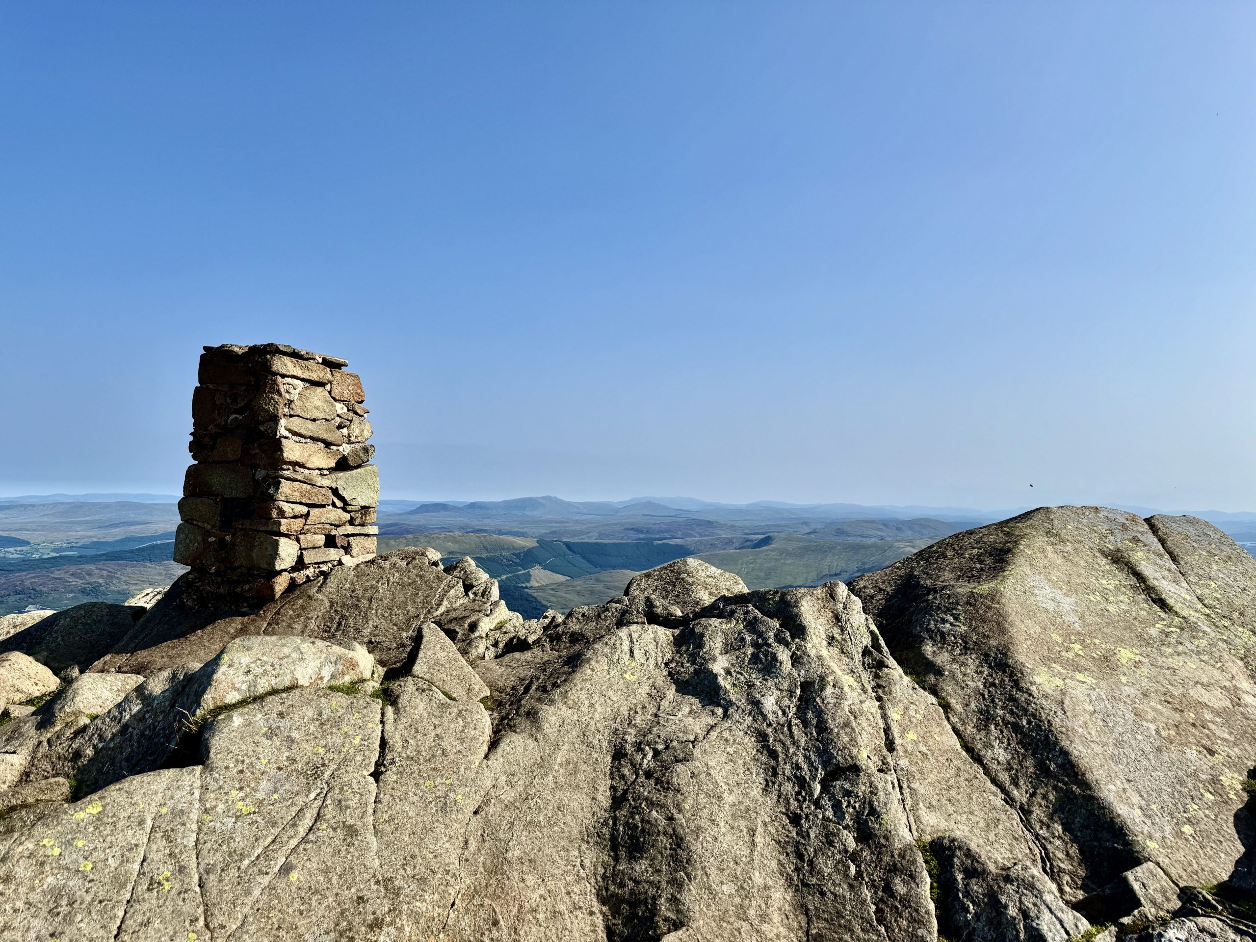
Starting with Sgòr Gaoith means heading for Glen Feshie where there’s a small car park at the edge of the forest you walk through:

The route is a relatively straightforward one. It’s just over 15km based on AllTrails (but it came in slightly longer as they generally all do in reality for me).
Here’s the simplest and quickest out and back route:
The path is largely easy to follow!
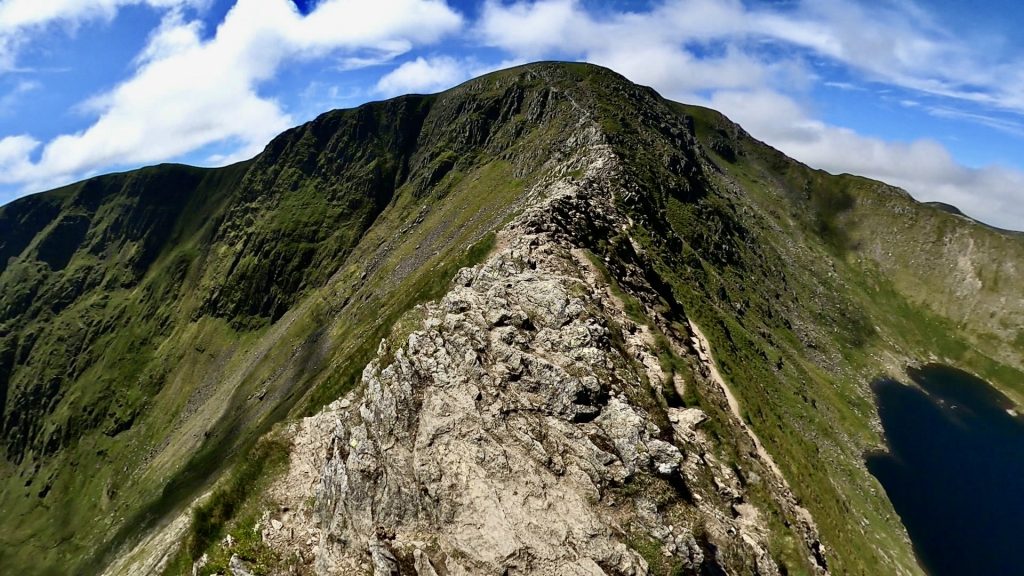
Once you make it back to Glen Feshie, you’ll need to be in the car and set for a long drive to Swirls Car Park (postcode CA12 4TW). This will take you to the start of the shortest route up and down Helvellyn:
Expect it to come in longer than 7.2km in reality – I’ve never had one yet that didn’t come in longer than an AllTrails estimate! But this should be do-able in a relatively short space of time and you can hit the road again to head for North Wales.
Caseg Fraith, Capel Curig, Betws-y-Coed, Gwynedd – that’s where you’re driving now.
And this will take you to a small car park at the foot of the simplest way up and down Carnedd Llewelyn:
In all, completing this will see you drive 450 miles, hike 34km and battle with 2,390m of elevation. Not bad. You’ll have definitely earned that pint at the end!
The Welsh 3000s – Far Less Driving But a BIG Old Challenge
If you prefer your hikes with a LOT less driving and a lot MORE elevation, then the Welsh 3000s is on HELL of a challenge.
Caveat – I’ve never done this as a one day challenge. I’ve covered 12 of the 15 Welsh 3000s but across a few different hikes. This is on the list for me next year though for sure.
| Hiking distance | 46.3km |
| Elevation | 3,970m |
So the task is to complete this within 24 hours, but the timer starts when you hit your first summit (Crib Goch) and ends when you hit the last one (Foel Fras). But this distance here includes the walks to the first summit and back down from the last one.
There are SO many challenges with this one. First up, the distance and elevation alone are significant challenges. But add to that exposed srambles up the likes of Crib Goch and Tryfan and rocky terrain across the board and you start to see how mammoth it is.
I’d like to do this one in June next year with lots of daylight available!
The Yorkshire 3 Peaks
The Yorkshire 3 Peaks encompasses no driving and less elevation and distance than the Welsh 3000s.
But this is still a big old day.
| Hiking distance | 39.4km |
| Elevation | 1,596m |
It takes in the peaks of Pen Y Ghent, Whernside and Ingleborough. Lots of the distance is covered in the in between bits (take trainers for those). Many shoot for this in under 12 hours. Some people do it much quicker. I scraped it in just under 12!!
Other Alternatives to the National 3 Peaks
Over to you. What other hiking challenges do you know of that would present a suitable hiking challenge alternative to the National Three Peaks – but would avoid lots of the crowds?