Do you know how long it takes to drive to Assynt from where I live?
Over 8 hours 😂 but it’s worth it. What a stunning part of the world.
I went with my eye on bagging the only two Munros in the whole of the Assynt area (which in itself is hard to believe when you look at some of those not high enough to qualify).
So, the target was Conival and Ben More Assynt. We were staying in Inchnadamph Explorer’s Lodge, right at the start of the trail, which was just brilliantly located.
Now, I’ll start by saying this is a review of Conival but sadly not Ben More Assynt. This is the one where we turned back! And let’s dive into the route, the reasons and some incredible photos from what was a wonderful hike despite missing the second summit.
Conival (But Not Ben More Assynt 😞) Summary
| Hike date | 27th April 2024 |
| Weather conditions | All over the place. Started nice and clear. Then a load of snow. Then clear again. And then snowy again. Cold. |
| Distance hiked | Approx 21.5km (as measured on Apple Watch – longer than the AllTrails estimate for the route even including Ben More Assynt) but I often find this the case. We went off trail for bits of it to nosey about etc. |
| Walking time | 10.5 hours (including all the photo stops, lunch stops and so forth) |
| Elevation gain total | 974m |
| Terrain | Boggy ground on initial ascent. Rocky from then on. Lots of loose scree. |
| Hiked with | Solo |
Conival and Ben More Assynt Route
We followed this route.
It starts at the Inchnadamph Explorer’s Lodge. You can stay there (if you can get booked in) or drive up of course.
The route starts on a vehicle track which goes up as far as a house a little way up the slope:

From here, you move to a narrower path (but still well maintained) on a relatively long valley walk in along the side of the river. The views of the first target summit of Conival are immense from here.

From this angle, Conival looks quite unassailable. But don’t worry – there’s no discernible path in view because you don’t go up that currently visible face of the mountain.
The gradient here is slight and actually this is a really enjoyable start and lets you get those calves warmed up before you start gaining elevation at any real pace.
Eventually, you start to ascend at a faster rate. The path can be pretty boggy here in parts. It does get rockier in places but you’ll often find yourself crossing small streams like this:

The scenery now becomes much more rocky and, frankly, utterly beautiful.

Before hiking up Conival, I’d heard people describe parts of it as a scramble. The only real scrambling element (not talking about just use of hands to steady yourself over rocks here) is the quartzite buttress you’ll come to:

It’s very doable though and isn’t a complex or graded scramble. You’ll come back down this way later too.
From here, while there is a path it isn’t particularly “easy” to follow. It’s a rocky ascent and actually with so much loose scree on the path we ended up ascending slightly off to the right of it.

It gets steeper!

But then you hit the ridge line and the short few hundred metre walk to the summit is relatively flat:

Note the change in weather conditions here!!
Turning Back from Ben More Assynt
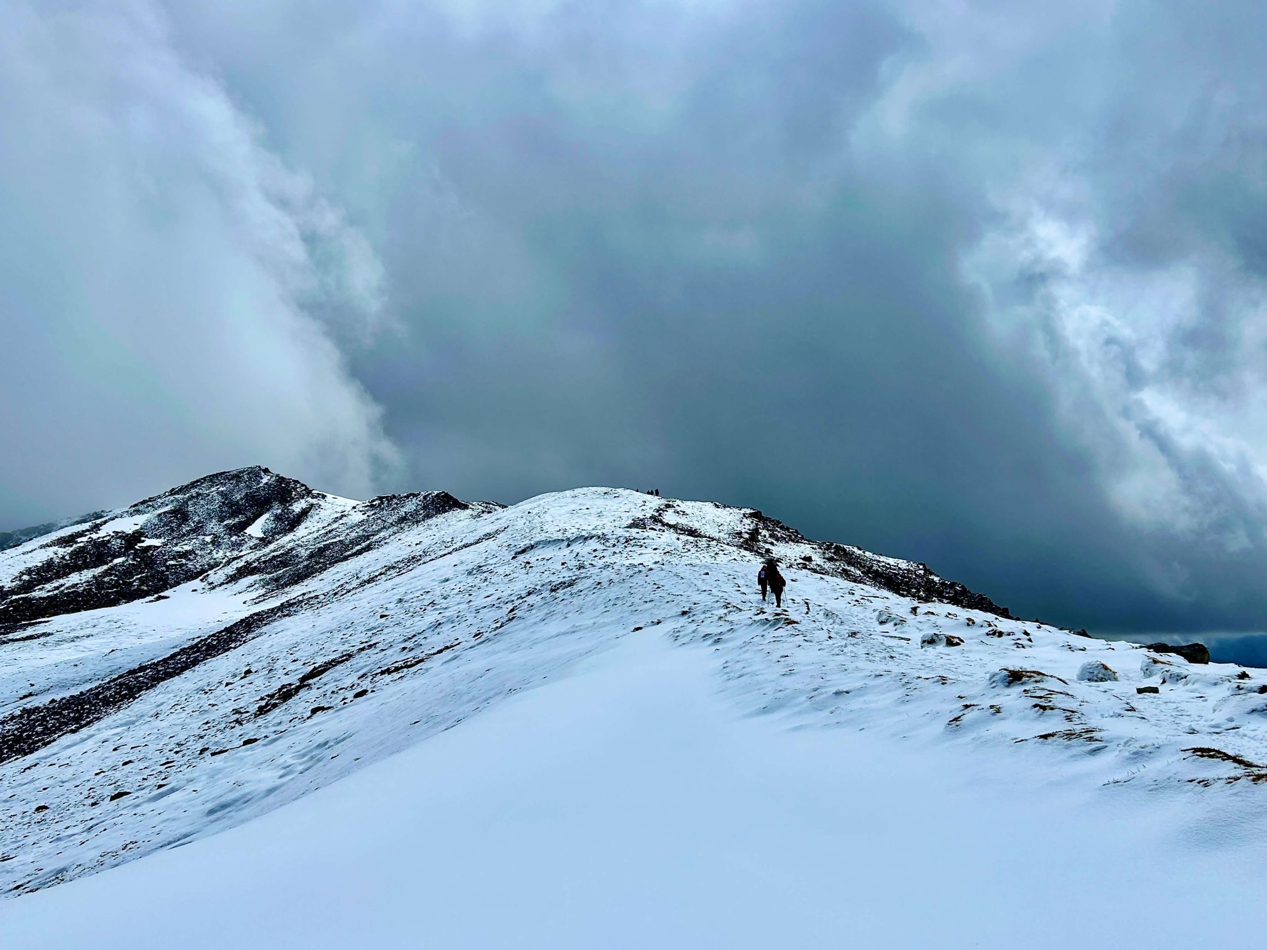
As we reached the final ascent to Conival, it was around 11am. We were aware that snow was forecast between some time after 4pm. But the snow arrived at 11. Visibility all but disappeared and conditions underfoot became quite slippy.
When we arrived at the summit of Conival, visibility was zero. We headed towards the descent onto the ridge towards Ben More Assynt and began to make our way down.

But conditions were mightily slippy underfoot. And even with spikes, this felt treacherous.
I’m not a fair weather hiker. I’ll hike in most non-dangerous conditions. But I AM a fair weather scrambler when I have a choice. After discussions between us and realising nobody was particularly comfortable even with simple scrambling (and with the prospect of a view on Ben More Assynt looking slim) we abandoned. It felt disappointing with Ben More being just 1.5km away. But we felt it was the right and safest call.
The route back took us back to the summit of Conival and back down the way we came in.
And here’s where our fortunes changed! Having had absolutely no views whatsoever when we first summited Conival, our return saw the clouds clear (though they still shrouded the nearby Ben More Assynt). So we did get our views from the summit of Conival:

The Descent
Arguably this is harder than the ascent. Loose scree coupled with fresh snow and big boulders meant progress down was slow. Then we got back to the valley and it was still another 6km or so to get back to the Explorer’s Lodge.
The weather was much better for that closing part of the hike though!
Would I Hike Conival Again?
Yes. It was stunning. And, frankly I’ll have to hike it again if I want to bag Ben More Assynt as that looks to the best route in!


